Atmospheric River Brings Significant Flows to the Flathead Wild & Scenic Rivers
December 8th-11th, 2025, an atmospheric river event delivered prolonged, moisture-rich storms across Northwest Montana, driving rapid runoff and notable rises on the Middle Fork and North Fork of the Flathead River. Both rivers peaked in the early morning hours of December 12th, 2025. Flathead Rivers Alliance tracked conditions throughout the event, monitoring USGS gage data, precipitation totals, and on-the-ground impacts to better understand how these powerful systems affect our Wild & Scenic rivers.
This post summarizes the hydrologic response, places the event in historical context, and highlights why continued monitoring matters for river health, public safety, and long-term stewardship.
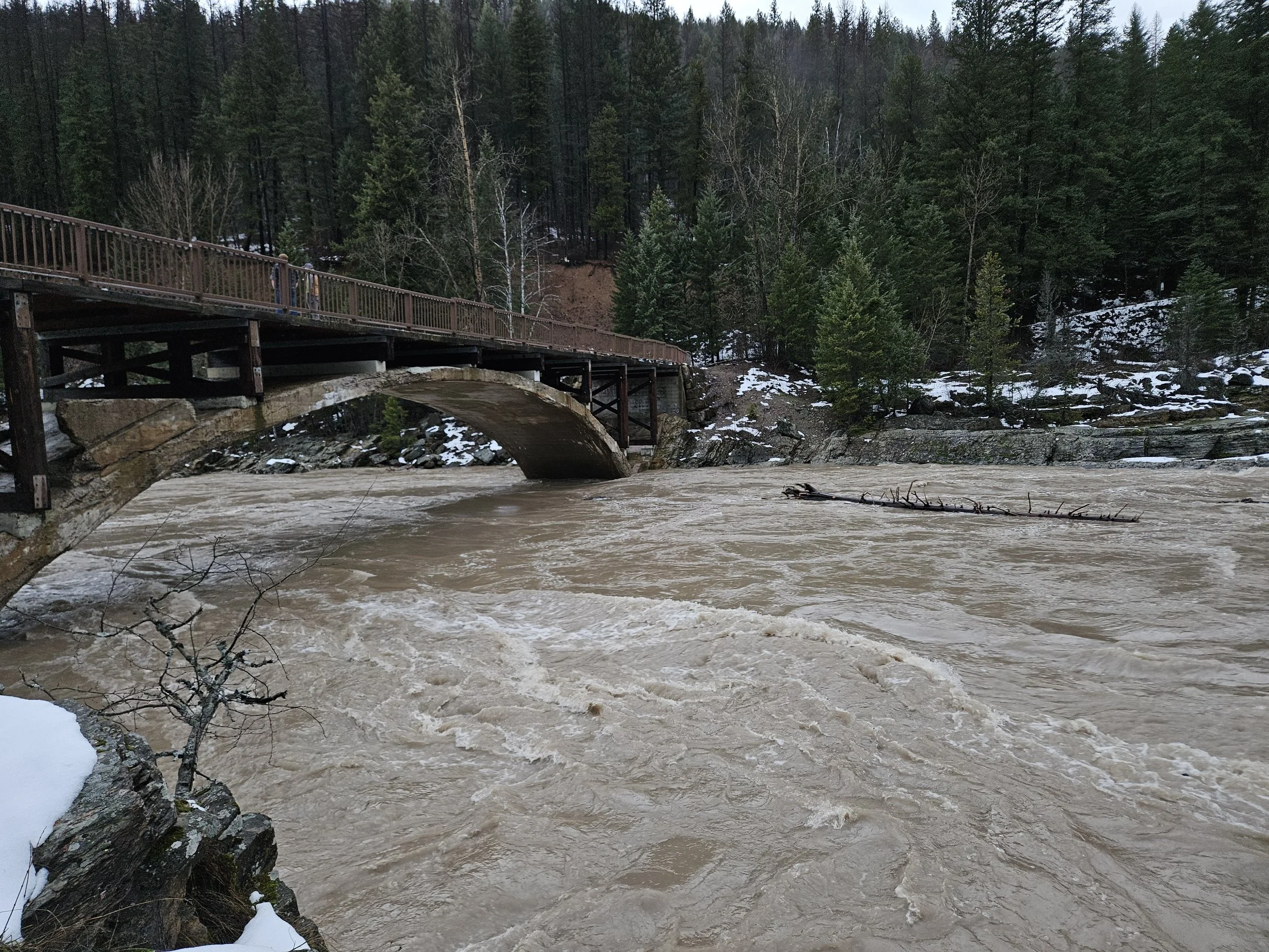
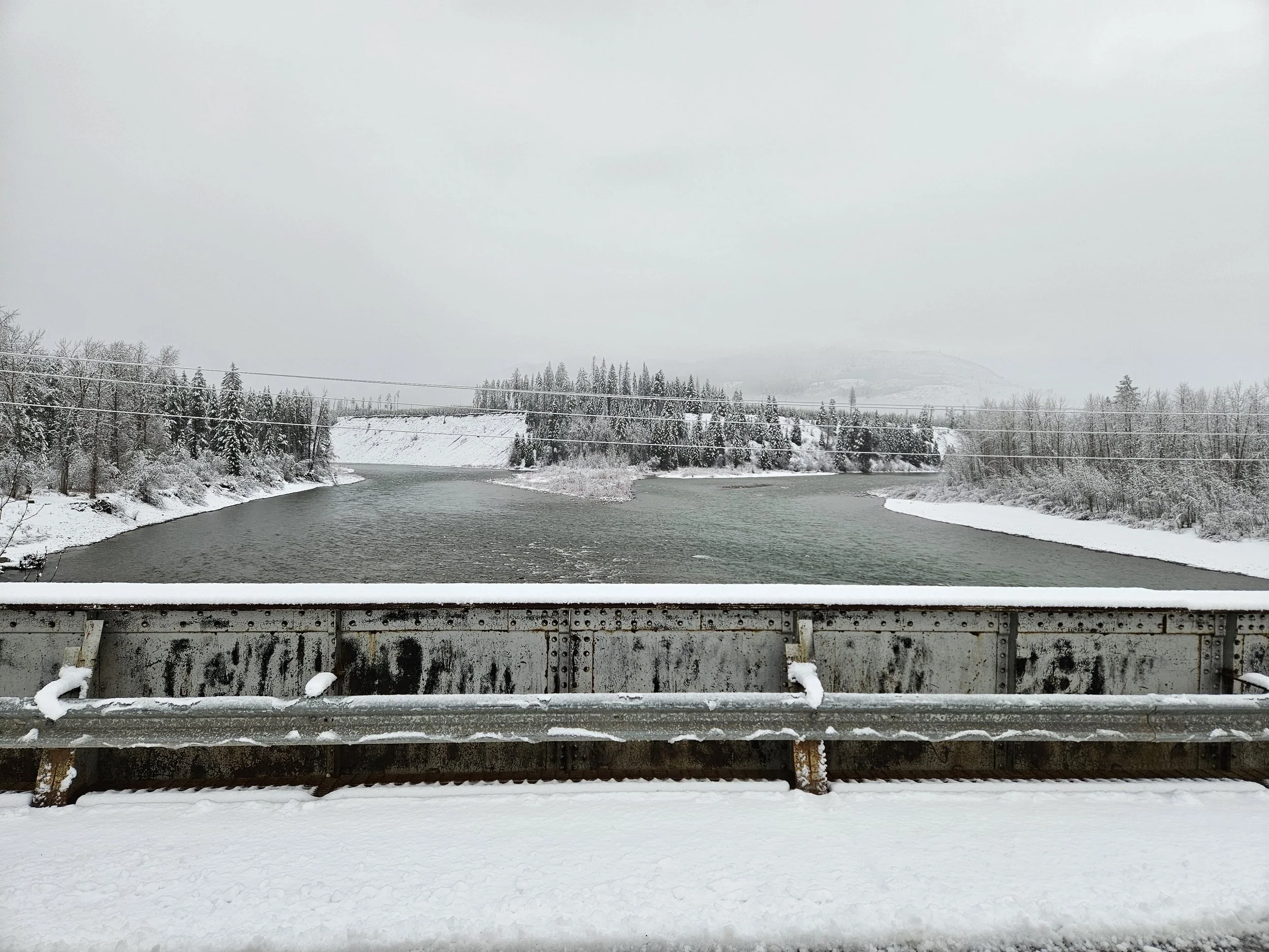
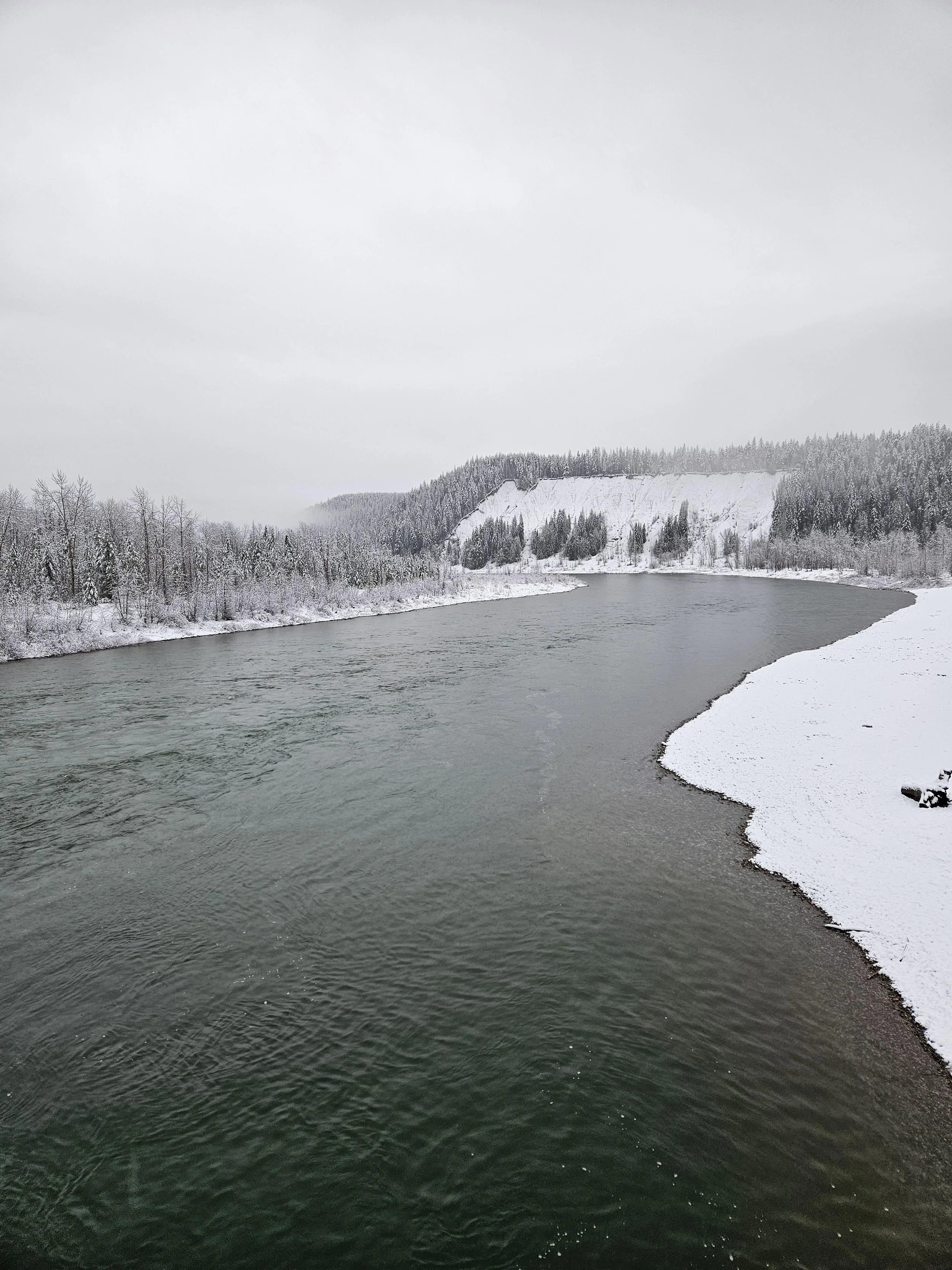
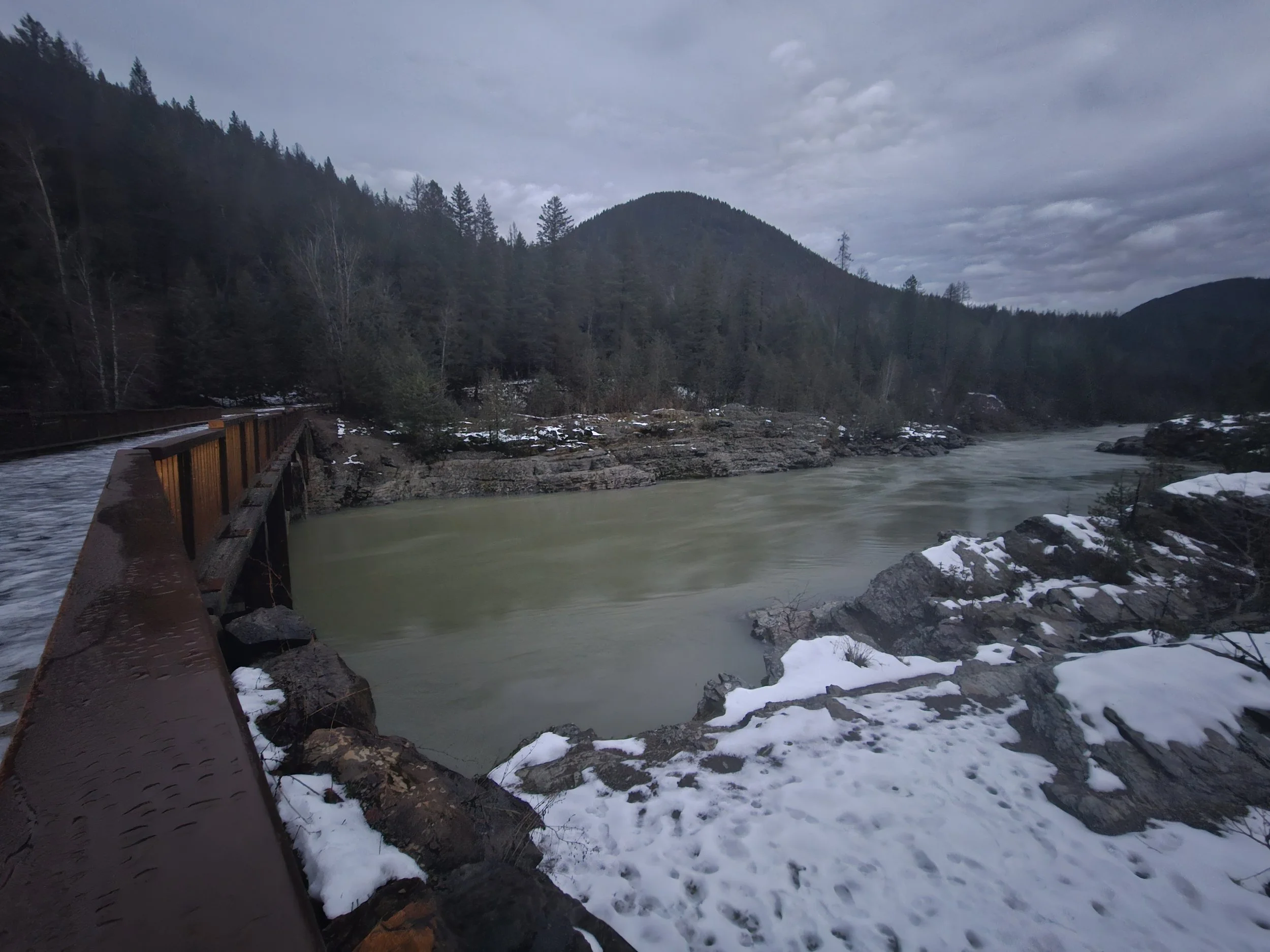
Large woody debris floats towards Belton Bridge on the Middle Fork of the Flathead Wild & Scenic River, near West Glacier, MT.
What Is an Atmospheric River?
Atmospheric rivers are long, narrow corridors of concentrated water vapor that can transport immense amounts of moisture from the Pacific Ocean inland. When these systems stall over mountainous terrain like the Flathead Range, the resulting precipitation can quickly translate into elevated river flows, especially when rain falls on existing snowpack.
Event Snapshot: Key Hydrologic Statistics
(All provisional data from USGS gage stations unless otherwise noted. Updates may be made as additional information becomes available.)
Middle Fork Flathead River
Monitoring Site: USGS 12358500 M F Flathead River near West Glacier MT
Peak flow: 20,700 cfs recorded Dec. 12, 2025 01:15:00 AM MST *Discharge was 20,600 cfs at 01:10:00 AM MST and 01:30:00 AM MST
Pre-event flow: 1,140 cfs Dec. 8, 2025 11:45:00 AM MST
Percent Increase: River discharge increased by approximately 1,716%, nearly an 18-fold (almost 20×) rise over 85.5 hours, climbing from 1,140 cfs on December 8, 2025 to 20,700 cfs by early December 12, 2025.
2025 Spring peak flow: ~12,400 cfs May 12, 2025 15:00:00 PM MDT
Data sourced: M F Flathead River near West Glacier MT - USGS Water Data for the NationHistorical comparison:
Date comparison flows observed:
20,700 cfs - Dec. 12, 2025 01:15:00 AM MST
533 cfs - Dec. 12, 2024 01:15:00 AM MST
Data sourced: M F Flathead River near West Glacier MT - USGS Water Data for the NationThe peak on the Middle Fork of the Flathead River was a 2.4-year flood with ~40% chance of occurring each year.
The only other recorded peak streamflows recorded outside of spring runoff period are Nov. 8, 2006 at 18,700 cfs and Nov. 12, 1989 at 33,700 cfs (USGS Surface Water for USA: Peak Streamflow).
Graphs: Middle Fork hydrographs with hydrologic event marked


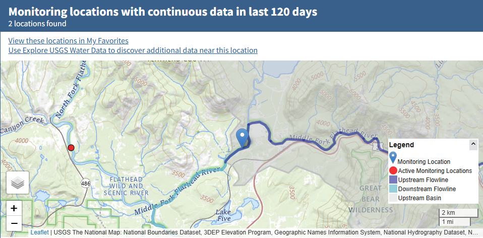
Graphs & map sourced: M F Flathead River near West Glacier MT - USGS Water Data for the Nation
North Fork Flathead River
Monitoring Site: USGS 12355500 N F Flathead River nr Columbia Falls MT
Peak flow: 9,710 cfs on 12-12-2025 03:15:00 AM MST and 06:00:00 AM MST
Pre-event flow: 1,140 cfs 12-08-2025 15:30:00 PM MST
2025 Spring peak flow: ~12,900 cfs May 13, 2025 08:15:00 AM MDT
Data sourced: N F Flathead River nr Columbia Falls MT - USGS Water Data for the NationHistorical comparison:
Comparable to flows observed:
9,710 cfs - Dec. 12th, 2025 03:15:00 AM MST
635 cfs - Dec. 12th, 2024 03:15:00 AM MST
Data sourced: N F Flathead River nr Columbia Falls MT - USGS Water Data for the NationThe peak on the North Fork of Flathead River was ~1-year flood.
The only other recorded peak streamflow recorded outside of spring runoff period was recorded Nov. 8, 2006 at 19,200 cfs (USGS Surface Water for USA: Peak Streamflow).
North Fork Hydrographs with Hydrologic Event Highlighted
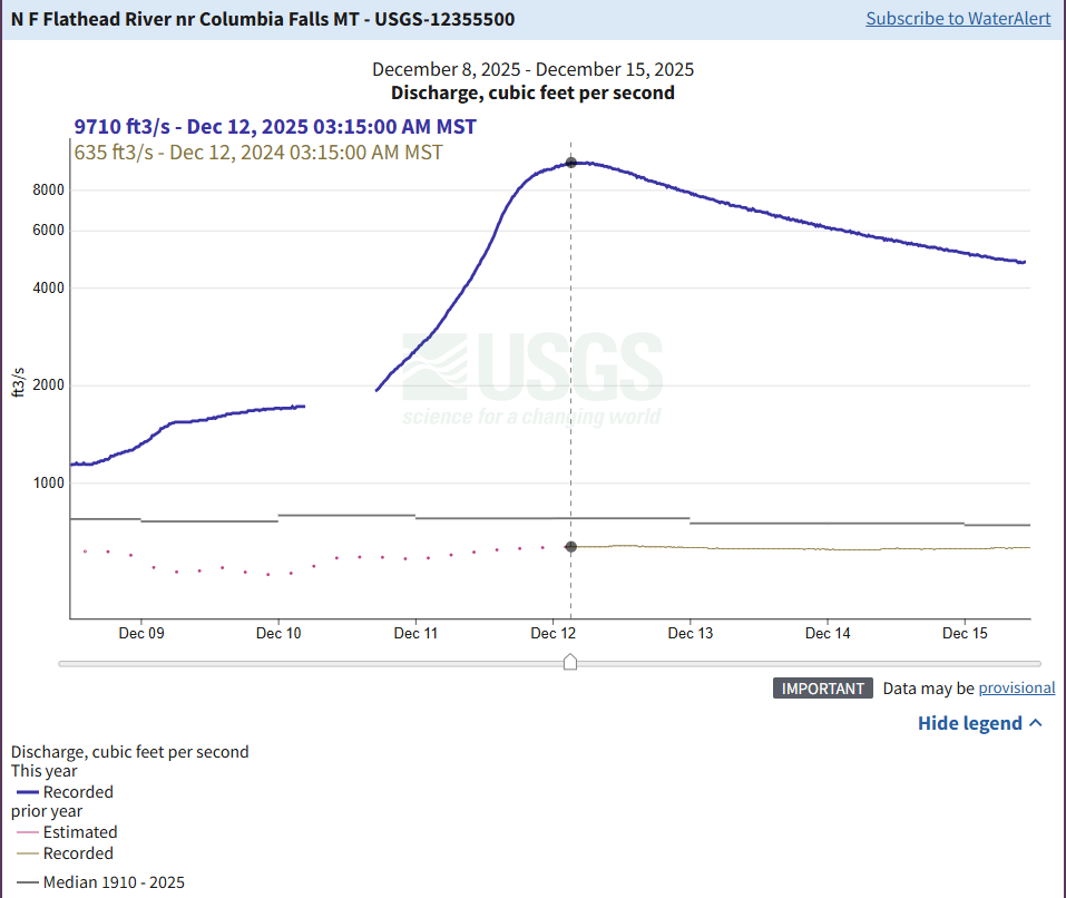


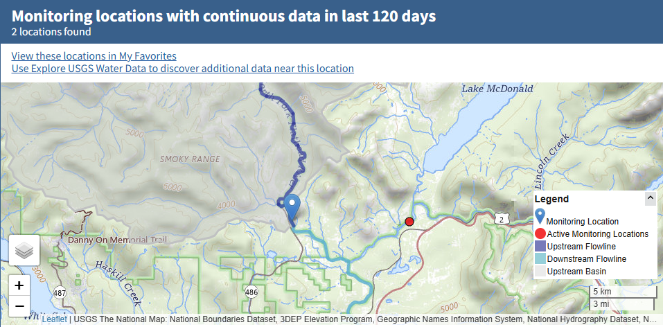
Graphs & map sourced: N F Flathead River nr Columbia Falls MT - USGS Water Data for the Nation
Precipitation & Snowpack Context
Storm total precipitation: ~4.6 inches over 72 hour precipitation total recorded, at Flattop Mountain SNOTEL site, as of Dec. 12, 2025.
Flattop Mountain SNOTEL is the primary station used for the Middle Fork headwaters because its watershed drains into McDonald Creek and directly into the Middle Fork Flathead River.
Pike Creek and Emery Creek provide additional context for spatial variability within the broader Flathead headwaters, including Middle Fork tributaries.
Rain-on-snow contribution: Significant
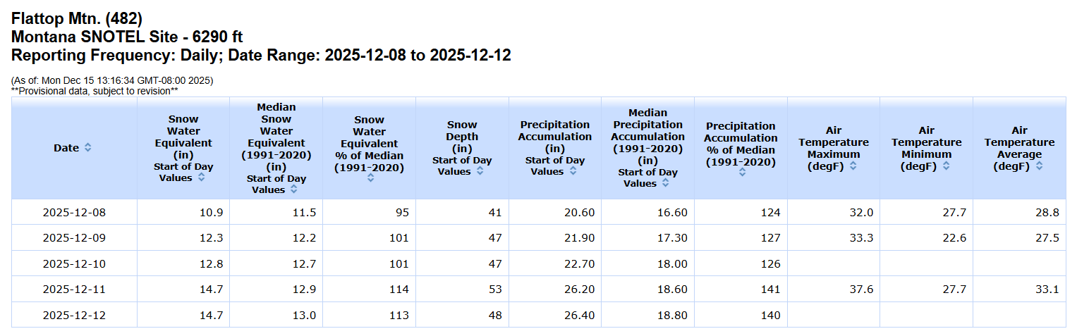
USDA Natural Resources Conservation Service (NRCS). Flattop Mountain SNOTEL Station Data. Available online: https://wcc.sc.egov.usda.gov/nwcc/site?sitenum=482&state=mt
Additional Data Resources:
NOAA/NWS Northwest River Forecast Center. Flathead Basin Precipitation Summary. https://www.nwrfc.noaa.gov
Three Forks of the Flathead River: Alerts, Trip Planning, Outfitter, & Resources. https://www.flatheadrivers.org/river-alerts-gear-trip-planning-tips-outfitters-resources
Current River Flows + Temperatures. https://www.flatheadrivers.org/three-forks-of-the-flathead-river-flows
How This Event Compares Historically
While the atmospheric river did not reach record-breaking flood levels, it stands out for:
The speed of the rise
Above-average flows for this time of year
A clear example of rain-on-snow dynamics, which can amplify runoff
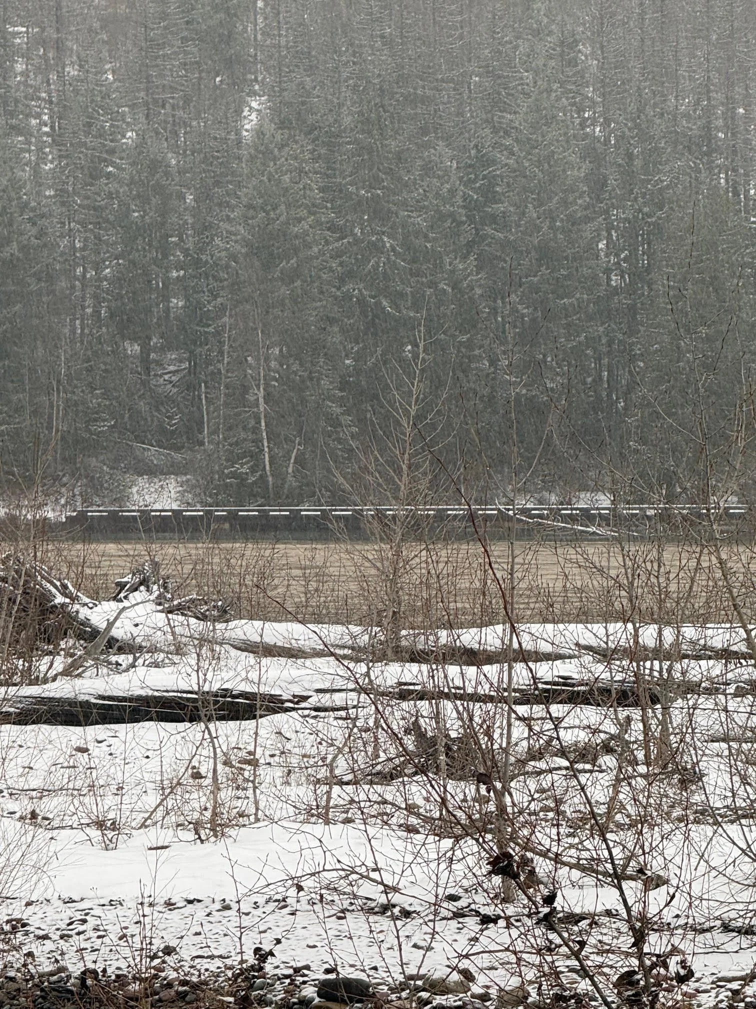
Observed River & Community Impacts
During and immediately following the event, Flathead Rivers Alliance staff and partners observed:
Storm appeared to concentrate in the Middle Fork drainage
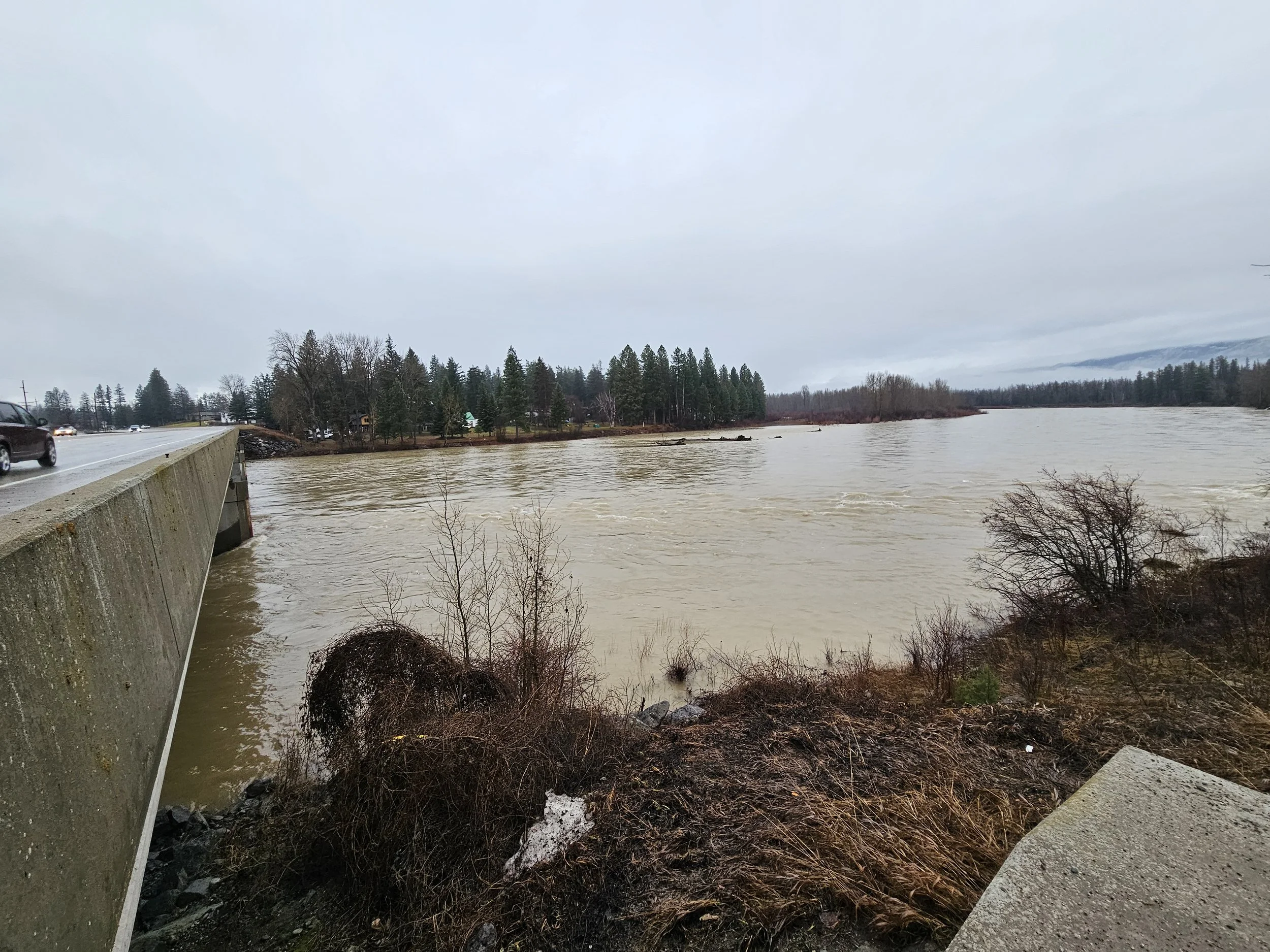
Elevated turbidity and sediment transport
Bankfull or near-bankfull conditions in select reaches
Limited overbank flooding in low-lying areas
Increased debris movement, including large woody material
Winter flooding in Montana rivers brings both challenges and benefits. While high flows can wash out fish eggs and reshape river habitats, they also play a critical role in maintaining healthy rivers over the long term. Floodwaters help clear sediment, form new gravel bars for spawning, improve habitat connectivity by redistributing logjams and nutrients which ultimately supports thriving trout populations once the waters recede and clear.


Why Monitoring Matters
Tracking events like this atmospheric river helps us:
Provide timely, science-based information to the community
Understand how climate-driven shifts may influence future flow regimes
Advocate for resilient river corridors and floodplain connectivity
Inform recreation safety and infrastructure planning
As atmospheric rivers become more variable and potentially more intense long-term datasets from the Middle and North Forks are essential for protecting the Wild & Scenic character of the Flathead River system.
Stay Engaged
Flathead Rivers Alliance will continue to monitor river conditions and share updates during high-water events and throughout the year. You can stay connected and support this work by taking a few simple actions:
Subscribe to our e‑Newsletter
Get timely river updates, event announcements, and behind-the-scenes looks at our monitoring and stewardship work delivered straight to your inbox.
Follow us on social media
Stay up to date with real-time river conditions, photos from the field, and opportunities to get involved.
Instagram: @FlatheadRiversAlliance
Facebook: Flathead Rivers Alliance
Make a donation
Your support helps fund river monitoring, data-driven advocacy, education, and on-the-ground stewardship that protects the Three Forks of the Flathead River, safeguarding the future of the Flathead River system.
Every subscription, follow, and donation strengthens our ability to safeguard these Wild & Scenic rivers—today and for future generations.
Together, we can ensure the Flathead’s Wild & Scenic rivers remain healthy, resilient, and free-flowing for generations to come.
CONGRATULATIONS to @mountainsandmontana on IG for guessing 20,600 cfs peak streamflow for Middle Fork of the Flathead Wild & Scenic River @ West Glacier USGS gage station. They were closest to the recorded peak streamflow at that site.